Everest and Dolomites in 3D
Explore Mount Everest and the Dolomites with a 3D application.

 Copia link

 1 / 2
1 / 2
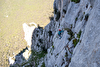
Everest seen from the south
 3drealitymaps
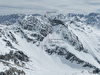
Ever wanted to check out Everest close-up? Explore the route through the Khumbu icefall? See how steep it is to climb up the South Face to the Western Cwm before continuing up to the summit of Everest? Or examine the difficult Second Step on the North Face route and the worrying Hornbein Couloir? Well thanks to a new 3D map this is all possible, without the need for supplementary oxygen and from the comfort of your own home.
The 3D RealityMap is free and is the result of high resolution satellite images of the Mount Everest region and transformed into a 3D visualization of the highest mountain in the world. A similar technology has been used successfully in the past in other areas, such as the Italian Dolomites where aerial photos have been used to provide nigh milimeter precision. So after having checked out Chomalunga from the north or south we recommend a trip to the impressive Tre Cime di Lavaredo, the mighty Sella group and obviously their Queen, the Marmolada with its sheer south face.
The 3D RealityMap is free and is the result of high resolution satellite images of the Mount Everest region and transformed into a 3D visualization of the highest mountain in the world. A similar technology has been used successfully in the past in other areas, such as the Italian Dolomites where aerial photos have been used to provide nigh milimeter precision. So after having checked out Chomalunga from the north or south we recommend a trip to the impressive Tre Cime di Lavaredo, the mighty Sella group and obviously their Queen, the Marmolada with its sheer south face.
Everest 3D
Note:
| www | |
| www.everest3d.de | |
| www.3dolomiti.it | |
Latest news


Expo / News
Expo / Products
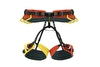

Fully adjustable harness with four buckles, ideal for mountaineering, winter climbing and via ferrata.
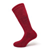

Merino Wool Mountaineering Sock.

Minimalist, lightweight jacket


A lightweight and essential mountaineering backpack


An agile and lightweight mid-cut boot for mixed-terrain hiking.

Ocun Diamond S climbing shoes designed for maximum performance, comfort, and precision