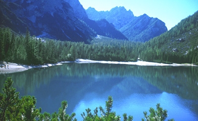
Val dei Chenopi - Plätzwiese - Carbonin

 1 / 9
1 / 9
Val dei Chenopi - Plätzwiese - Carbonin: © Enrico Maioni
 Planetmountain
Beauty


By
Enrico Maioni, Mountain Guide
Ascent height difference
470m
Descent height difference
550m
Time
2 hours
What I am about to describe is a pleasant walk in the mountains, neither difficult nor dangerous, which starts at the Cimabanche Pass (1529 m) and leads us to Prato Piazza, the plateau that extends up to an altitude of about 2000m. This plateau is protected by UNESCO because of its precious alpine ecosystem and its wonderful panorama.
The walk is well-known to local hikers and insiders, but ignored by most walkers who tend to head to other equally beautiful, but far more noisy and crowded places such as Nuvolau, Croda da Lago, Fodara and Sennes to name but a few.
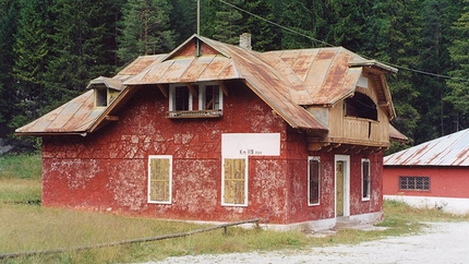
The starting point is Passo di Cimabanche (Sórabànces in Ladin), the almost imperceptible mountain pass situated on the Alemagna highway, roughly halfway between Cortina and Toblach. I recommend you park the car just after the pass as you drive toward Toblach close to the old roadhouse (km 119), easily recognizable due to its typical Pompeian red colour.
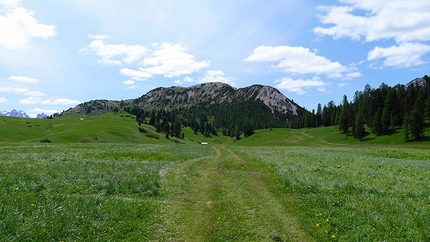
The path is indicated clearly (#18) and leads off NW through the sparse forest. Almost flat at first, the path then begins to ascend slowly up through the Val dei Chenopi.
The river Ru dei Chenòpe runs through the valley and originates at Pratopiazza. The name of the small river and the valley comes from the Pustertal miners who walked this route to reach the mines at Giau: chenòpo, -pe in Ampezzo dialect, stems from the German Knappe (in dialect Knop), meaning "miner".
The steep walls of Col Rotondo dei Canopi appear on the right, while the last outcrops of Ra Šàres can be seen on the left before they give way to Còšta del Pin, the green and rocky shoulder of Croda Rossa d’Ampezzo.
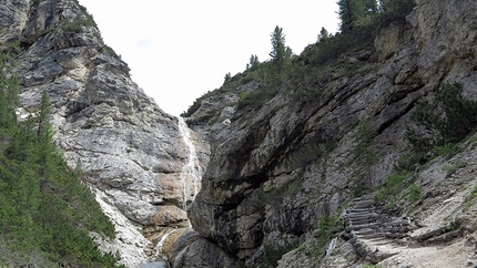
After crossing the stream a few times a rocky gorg suddenly seems to block the way. The path becomes more steep at this point and winds its way past scree and pine trees up the steepest section (Please note: In spring, if there is still snow on the ground, this stretch can be dangerous).
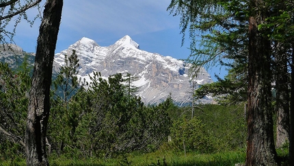
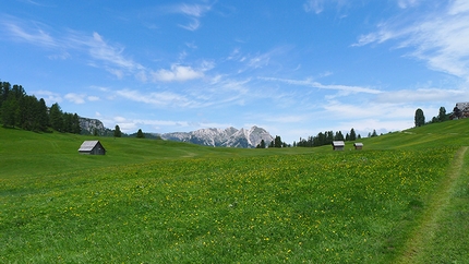
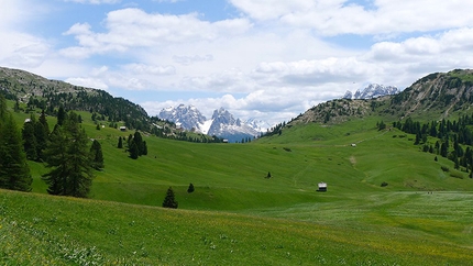
At Plätzwiese there is no shortage of cows, and what cows! The path leads quickly out of the forest and the view onto the grassy pass of Plätzwiese (Pratopiazza in Italian) is truly spectacular! In addition to Dürrenstein, the view sweeps out onto the Tre Cime di Lavaredo, Tofane and Monte Cristallo. What is most striking of all though is the imposing Croda Rossa d'Ampezzo, a grandiose, motley-coloured mass of dolomite.
I want to clarify that the correct spelling, in Italian, of this beautiful corner of the Dolomites is Pratopiazza, and not Prato Piazza, which although far more common is actually wrong according to the experts. I've included both versions, to make sure the article is indexed properly, since Prato Piazza is used far more ofter as the search words.
This point can also be reached via a tarmacked road from Braies (Ponticello); traffic is limited along the section between Braies (barrier and car park) and Pratopiazza from mid-June to early October, and a shuttle bus runs from 10.00 to 16.00. In the winter you can only drive up here with winter tires or chains.
There's a hotel (Hotel Hohe Gaisl) on the plateau as well as two mountain huts, Berggasthof Plätzwiese and Dürrensteinhütte, where you can spend the night. Close to the latter and at the southern end of the plateau are the ruins of Sperrwerk Plätzwiese, the remains of a fort dating back to the Austro-Hungarian Empire.
Plätzwiese is very popular with tourists both in summer and in winter. In summer it is the starting point for many hikes including the path that leads to the summit of Dürrenstein. In winter this is an ideal location for ski mountaineering and nordic skiing since there tends to be plenty of snow throughout winter. The plateau is located in the Natural Park Fanes-Senes-Braies, and offers visitors peace and tranquility.
Those who like traditional food will certainly enjoy stopping off at Berggasthof Plätzwiese: local specialties can be eaten all year round in the typical Tyrolean Stuben. The combination of local and Italian cuisine is superb and results in favourites such as the tris of pasta and Tyrolease gnocchi, the "Brettljausen" (typical snacks), Knödel soups or homemade cakes that blend in perfectly with the landscape.
But now the time has come to continue our journey, and we do so by following the white track that crosses the plateau and then slowly begins its descent south towards Carbonin. Numerous shortcuts, never too steep, enable you to shorten the return and render it slightly more "wild".
Once you reach Carbonin a final ascent leads back to the parking lot and starting point of this walk. It's worth crossing the road at this point and walking along the tracks of the former railway, where the "Train the Dolomites" rattled along until 1964. "Sunday, May 17, 1964 was the last day for the Dolomites railway ... Absenteeism and total indifference unfortunately characterized this moment; everyone had forgotten how much this blue-white train had given to everyone for so many years. It disappeared in silence, almost aware that its time had come. The only emotion that could be felt was from the railwaymen who, with great sadness, watched it for the last time." (Taken from the wonderful book written by Evaldo Gaspari entitled "La Ferrovia delle Dolomiti. Calalzo – Cortina d’Ampezzo – Dobbiaco, 1921-1964″ – Distribuzione Casa Editrice Athesia, Bolzano 1994)
Today this track is used for cross-country skiing in winter and as a walking path in summer. Walk along this for 1.5km; take care not to walk too far, keep an eye out for the road and reach the old roadhouse and parking lot after circa 15 minutes.
Getting there
Passo Cimabanche is easily reached from Cortina d’Ampezzo by driving north along the SS51 d’Alemagna towards Toblach. Circa 15 km from Cortina, ore 17 km from Toblach.
Passo di Cimabanche can also be reached using the bus that runs between Toblach and Cortina.
NotesRistorante Chalet Passo Cimabanche – loc. Cimabanche – Tel: +39 0474 972442
Rifugio Plätzwiese – loc. Pratopiazza – Tel: +39 0474 748650
Rifugio Vallandro – loc. Pratopiazza – Tel: +39 0474 972505 – Cell: +39 346 3242967
 Comments
No comments yet...
Beauty


By
Enrico Maioni, Mountain Guide
Ascent height difference
470m
Descent height difference
550m
Time
2 hours
Routes in the same mountain group


 Copia link
 Enrico Maioni, Mountain Guide
 See all photos