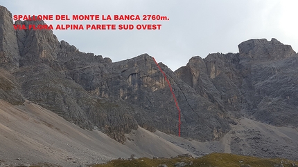
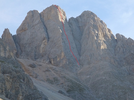
Schwalbenschwanz - Marmolada d'Ombretta

 1 / 4
1 / 4
Schwalbenschwanz
 Planetmountain
Beauty


First ascent
L. Rieser, R. Schiestl in 1978
By
Planetmountain
Orientation
S
Length
750m (19 pitches)
Height
3247m
Difficulty
6
Obligatory difficulty
6
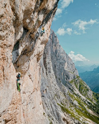
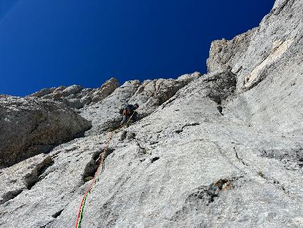
The Schwalbenschwanz, or swallow’s tail, starts to the right of the Don Quixote, climbing up similar rough compact grey slabs. Like its neighbour it follows an intelligent and fun line of ascent, weaving its way up the line of least resistance. The lower section is famous for the distinctive hole that enables climbers to cross the roofs beneath the half-height ledge, while the upper section weaves its way to the left and right of the long black streak. Beautiful face climbing leads to the long inclined chimney to the right of the pillar and the black water streak. The Schwalbenschwanz is without a doubt one of the most beautiful and enjoyable outings on the entire south face!
Getting there
Take the motorway A22 Modena-Brennero and exit, after Bolzano, at Ora. Drive up the Val di Fiemme to Predazzo, then up the Val di Fassa to Canazei. Continue on up to Passo Fedaia and then descend to Malga Ciapela. From the car park at Malga Ciapela take path no. 610 to Rifugio Onorato Falier (2080m), nestled beneath the South Face of the Marmolada (1.15 hrs from Malga Ciapela). For the routes situated on Punta Penia, continue on past Rif. Falier along path no. 610 to Rif. Contrin (2016m) located between the Val Contrin and the Val Rosalia. Access
From Rif. Falier follow path no. 610, to the narrow hairpin bends where it points up to Passo d'Ombretta (west); traverse right (east) across alpine meadows upwards to a ramp that leads up the pedestal to the base of the routes. The start of the route is located beneath the slanting small gully (circa 1 hour from Rif. Falier). Descent
Two 50m abseils down onto the glacier, then follow the piste to the half-way station of the Malga Ciapela cable car. Gear
Two 50 m ropes, pegs, full rack, plenty of Kevlar threads and slings. Notes
The grades indicated on the topo are in line with those already published in the Marmolada guidebooks by Maurizio Giordani and Heinz Mariacher.
 Comments
05/07/2010 Fabrizio Della Rossa
L'ho tentata intorno al 20 di giugno e ne esco con prezioso consiglio: x chi ci tenga a provare il passaggio per il buco (e in che altra via senò), andare a farla quando nn cè neve sopra che io l'ho trovato intasato di ghiaccio. Cmq io l'arrampicata nei camini sottostanti l'ho trovata piacevole.
08/09/2009 luca n struca
Fatta in questa strana estate...placche eccezionali meno i tortuosi camini e diedrini che prevalgono in via.Abbiamo trovato utili alcuni friend piccoli e schivato un bel temporale.Personalmente preferisco altre vie della fantastica sud,cmq da fare.
15/02/2005 Ceruti Massimo
Era la prima volta che mi accostavo alla Marmolada e nonostante avessi fatto tiri più duri nelle occidentali, mi ha dato parecchio filo da torcere. Purtroppo abbiamo sbagliato tutto tempi e sottovalutazione delle difficoltà. ci siamo fermati nella parte bassa all'altezza del buco. La relazione di Giordani è comunque sottovalutata, sono più propenso a riconoscere più attendibile quella di dinoia. I camini bagnati nella parte inferiore mi sembrano un pò più impegnativi del 4° 5° grado segnalato. Comunque via di grande respiro in un ambiente unico. Bisogna andarci ben preparati
22/09/2004 Beppe Ballico
Bella via, concordo che i tiri veramente entusiasmanti sono pochi e i restanti nei camini/diedri sono molto faticosi. Il superamento del buco con sasso incastrato mi ha dato parecchio filo da torcere. Il tetto dove dicono di passarci sotto e superarlo nel bordo sinistro, lo abbiamo superato direttamente, a mio avviso molto più comodo per evitare il forte attrito delle corde (passaggio di 6+). Per chi in questo periodo volesse ripetere la via, consiglio dopo la prima doppia di discesa, di dirigersi verso destra (faccia a valle) e prendere delle altre calate con moschettone che depositano oltre i numerosi crepacci.
Beauty


First ascent
L. Rieser, R. Schiestl in 1978
By
Planetmountain
Orientation
S
Length
750m (19 pitches)
Height
3247m
Difficulty
6
Obligatory difficulty
6
Routes in the same mountain group


 Copia link
 Planetmountain

