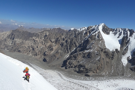
Minteke Valley: Muhz Teke, Pik Sindre, Pik Luis and other Dutch climbs in Pamir-Alay, Kyrgyzstan
 1 / 39
 Dutch Expedition 2022
In September 2022 a group of twelve Dutch climbers - Noor van der Veen, Regien Winnubst, Martin Platteschor, Dennis Hendrikx, Robert Löwensteyn, Sjoerd Boersma, Michiel Telkamp, Jeffrey Meesters, Anniek Verschuur, Bas Visscher (coach), Court Haegens (coach) and Boris Textor (guide) - climbed in the Min Teke valley. The expedition was part of the so-called Expedition Academy, a project of the Royal Dutch Climbing and Mountaineering Federation promoting expedition climbing under young alpinists.
The valley has been visited by western climbers only twice. However it is thought that most peaks have been climbed in the past by climbers from the Soviet states, presumably via the most accessible routes. In July 2019 a French expedition team visited the valley and climbed a route on Tobokal peak (5004m, North Ridge, 39°37'47.3"N 70°30'12.8"E) and Achu Peak (4500, South West Edge - South Face 39°38'52.05"N 70°32'23.02"E). In September 2019 a group of Swiss alpinists visited the valley, climbing Kyzyl-Muz, Pik 3, and Pik Min Teke, and opened a new traditionally protected rock route on Achu (see AAJ 2020).
Basecamp
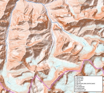
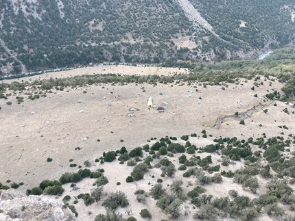
The Dutch team arrived in the valley on September 7th. Basecamp was established at 3000m (39.68361N 70.46603E) on a plateau before the junction of the two branches of the valley. Earlier, French and Swiss teams established basecamp a bit higher up, in the east branch. Basecamp was reached after a three day hike from Bezpass. After establishing basecamp, both the east and south branches of the valley were explored.
Hidden Peak
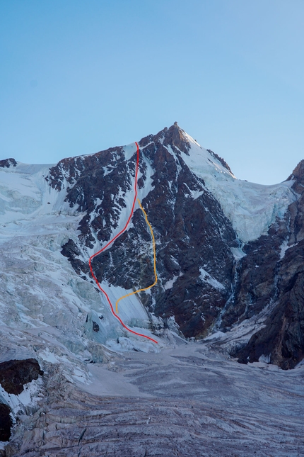
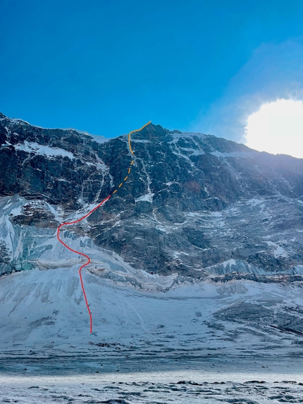
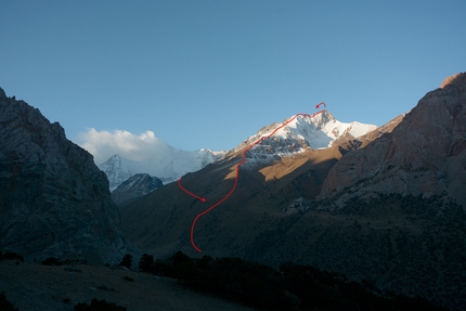
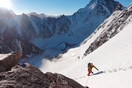
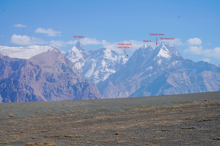
In the east branch the most prominent peak is Pik Stalin (ca 5190m). At first glance its north-face looked like an interesting, technical target. However, the group decided against attempting the face because of hard ice, no bivy spots, an active serac and a complicated descent. Fortunately the reconnaissance proved successful because the team spotted two ice lines on what they called ‘Hidden Peak’ (ca. 5000m, 39.6250242N 70.5122508E, located between Pik Stalin and Peak 3). The next week, in two teams, both routes were climbed, from an ABC on the glacier at the end of the valley (3900m). Noor, Regien en Bas climbed ‘Diagonale du Fou’ 1000hm, TD- AI3, M4 in the east couloir. Dennis and Anniek climbed ‘Directe du Fou’, a 400m ice line on the north face, followed by the east couloir at 4600m, 1000hm in total TD+ AI5 M4. The two groups teamed up together during the last part of the climb and decided to descend before reaching the summit after finishing the technical difficulties, at a height of ca. 4900m, because they hadn’t taken bivy equipment. They returned to ABC after 27 hours on the move.
Borborduk çoku (Central Peak), Pik Sindre
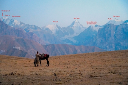
In the south branch the most prominent peak is Min Teke, climbed by the Swiss team following the northwest ridge. During a reconnaissance Robert, Noor, Martin and Jeffrey scrambled up a small rock peak (4105m) at the entrance of the valley. From here the group envisioned a link-up of three peaks on the east of Min Teke, of which one was attempted as a solo climb by one of the Swiss team members.
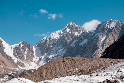
During a first attempt Martin, Robert, Sjoerd and Court climbed two of the three peaks. Starting from ABC on the right branch of the Kapa Typ glacier (4100m), they climbed the west ridge to the peak they called борбордук чоку / Borborduk çoku (39°36'30.5"N 70°27'11.9"E, 4830m), ‘Central Mountain’ in Kyrgyz. The next day they continued, climbing the east face of the snowy peak which they named Ak Too (5149m), meaning White Peak. Being unacclimatized, from here it was too far to continue to their third peak, and they decided to turn around.
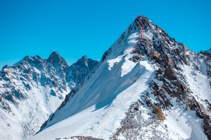
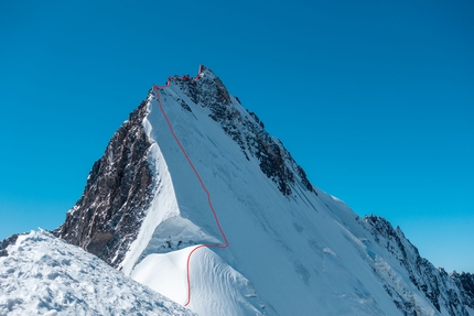
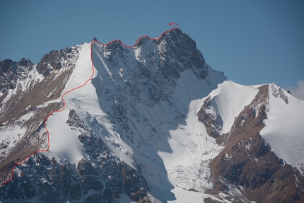
On a second attempt one week later, a team of Martin, Regien, Sjoerd and Court climbed to Ak Too in two days. From here they climbed the north east face, following the 60° ice and snow slope. Following the rocky east ridge 4c, they reached the top of the third peak, which they called Pik Sindre (5380m, 39°35'51.1"N 70°26'06.0"E, 700m, D), named after a deceased friend of Sjoerd.
Pik Luis
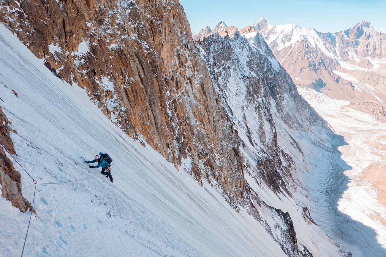
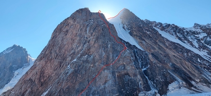
During the same window of good weather, two other teams also went up the south branch of the valley for attempts on two other peaks. Jeffrey and Michiel had set their eye on a technical line on an unnamed peak (N 39.600713° E 70.479784°, 5015m). From ABC at the left side of the right branch of the Kapa Typ glacier, they started climbing up the north face. In two days, they climbed the technical rockface, with pitches up to 6c, on rock of mixed quality. On their third day at the wall, they climbed the 400m long ice ridge to the top, which they called Pik Luis, named after named after a deceased friend of Michiel. They followed their traces back on the ice ridge and continued their descent on the fourth day over the north-east face (1000m route, ED, 6c, 70°).
Pik Elephant
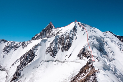
Meanwhile, team members Bas, Dennis and Anniek attempted Pik Elephant (ca. 5400, 39°36'21.1"N 70°31'04.2"E). They set up ABC at 4000m on the left branch of the Kapa Typ glacier. The next day they climbed the 700m west face up to 50° ice and started up the north ridge. After a bivouac at 5000m, the next day, the climbers continued on the north ridge. After a total of seven pitches on the ridge (20% of the ridge, up to M5), it was decided to abandon the attempt because of horrible snow, ice and rock conditions.
Attempted Ice line
From the same ABC, during another weather window, Robert and Dennis attempted an ice line on an unnamed peak between peak Elephant and Pik Luis. After 400m of moderate climbing over ice and snow up to 50°, followed by two short steep ice steps (up to 70°), they reached a steep, very narrow gully. The entire first pitch proved to be very thin chandelier ice. As the surrounding rock did not take protection either, the team decided to descend by abseiling the face.
Muhz Teke
Finally, in a single day push Robert and Noor climbed Muhz Teke (4948, 39°38'24.1"N 70°25'33.4"E), starting early at night from BC. The route was without snow until 4700m, after which the team climbed an icy slope (35°) followed by a relatively flat 500m ridge with rocky towers (steps III and IV) until the summit at 4950m. They descended partly by the ridge, until they found a way off through a scree slope on the north.
Rock climbs
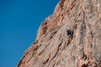
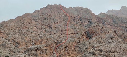
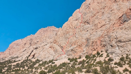
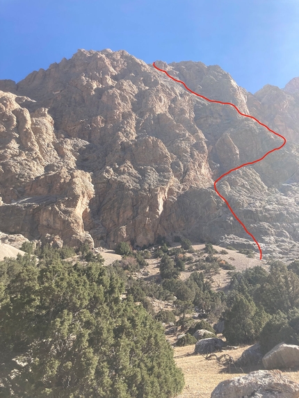
Throughout the expedition, many rock climbs were made. On the large limestone wall above the Swiss basecamp, three routes have been opened using traditional protection.
Jeffrey and Michiel climbed a 700m line up to 6b, named ‘Meesters Telkamp’. Robert and Dennis climbed a 400m line of 12 pitches up to 6a which they called ‘Scharf’. Bas, Regien and Anniek climbed a 800m line of 25 pitches up to 6a+, ‘Zigzag into the night’, after returning in the middle of the night in basecamp. All the teams went down on the other side of the mountain by first descending to the stream coming from Kyzyl Muz, crossing it, and then following the scree slopes back to the basecamp plateau.
Shorter rock climbs were done by the team on the limestone walls directly above basecamp. Court and Anniek climbed a 150m ridge line, VI with one step 5a, ‘Basecamp Tower’. Robert, Noor and Regien climbed a 200m line, 5b, ‘Ibex Poop’. Bas and Dennis climbed 100m up to 6a+, ‘Velcro’ and a 60m length 6a, ‘Zipper’. Jeffrey and Michiel climbed a 150m line up to 6a, (F)Eline. Robert opened a drytool pitch D7. Lastly, on a wall opposite basecamp (3850, 39.673003, 70.47108) Dennis and Michiel climbed a 300m line up to 6c, ‘Vulture nest’.
Overall ice and snow conditions weren’t favorable for long ice routes, with either hard, blank ice, or soft, airy ice, no good for belays. Rock quality was mixed, with stable granite rock walls at Pik Sindre and around Pik Achu, and very loose, sandy rock at Pik Elephant. Overall the weather was quite good, with some snow fall and strong winds high up, but also longer periods of stable weather, for 5-6 days.
The NKBV Expeditie Academie is sponsored by: La Sportiva, Petzl, Rab, Garmin, Julbo, Lowe Alpine, Mountain Network, Switzerland Tourism
Info: nkbv.nl/teams/expeditie
Instagram: expeditieacademie
Facebook: NKBVexpeditieacademie


 Copia link
 See all photos