Via Ferrata Giuseppe Olivieri - Punta Anna

 1 / 8
1 / 8
Via Ferrata Giuseppe Olivieri: Photo Tony Scott
 Planetmountain
Beauty


By
Planetmountain.com
Orientation
South
Ascent height difference
648m
Ferrata height difference
440m
Height
2731m
Difficulty
Difficult
Time
3.30 hrs. Complete 5 hrs
Period
From June to October, depending on the snow condition
Popularity
high
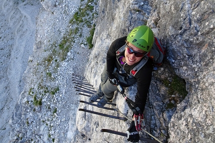
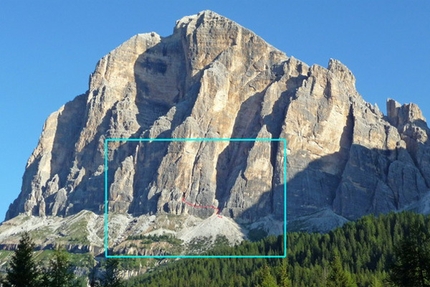
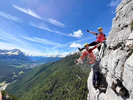
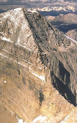
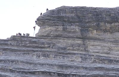
This ascent, almost entirely equipped with cables, follows the steep southern arête up Punta Anna, the large outcrop that looks onto the Tofana di Mezzo. Without a doubt one of the most interesting and beautiful via ferrata in the Dolomites, its steepness, exposure and beauty render it immensely satisfying, and the view onto the imposing south face of the Tofana di Rozes is unforgettable. The ferrata can be extended by combining it with others close by, including the ascent of the Tofana di Mezzo.
Getting there
By car: from Cortina take the road towards Passo Falzarego. Near a little church after Pocol, a signed track (signposted Rifugio Dibona) leads off to the right. Turn left at the next fork and continue to Rifugio Dibona.
By chairlift: from Cortina take the road towards Passo Falzarego. Just outside Cortina turn right following signs for restaurant Pietofana. From here take the chairlift first to Rifugio Duca d’Aosta and then to Rifugio Pomedes. Access
From Rifugio Dibona take path no.421 to Rifugio Pomedes. From Rifugio Pomedes follow the signposted path away from the top of the chairlift to the scree slope and then leftwards to the start of the ferrata beneath the east face of Punta Anna. Itinerary
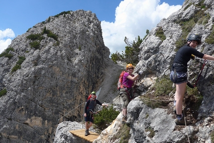
The steep and exposed ascent follows a line through the east face, then briefly onto the SW Face, before continuing on Punta Anna’s steep southern arête. Airy sections up extremely solid rock lead in about 1 hour to the beneath Punta Anna (2731m). From here there are two options. Either
1) follow the equipped ledges leftwards (signposted Giussani) to the scree slope that leads down from Bus de Tofana and enjoy the scree run down to path no. 403. This links Rif. Giussani to Rif. Dibona and leads gently back down to the starting point – recommended). Or
2) continue up the crest towards the Terza Torre Pomedes, via cables and easy slabs, to reach the Doss de Tofana and the descent path. Alternatively, continue from the Doss de Tofana to the summit of Tofana di Mezzo along the Via Ferrata Gianni Aglio. Descent
1) Descent along the Bus de Tofana scree slope: reach path no. 403 and descend to Rif. Dibona. Continue along path no. 421 to Rif. Pomedes if the starting point was at restaurant Pietofana.
2) Descent from the Doss di Tofana: follow the path towards the Ra Valles cable car station and then turn off right down Sentiero Giuseppe Olivieri. Equipped in the steepest sections, this leads swiftly to Rif. Pomedes. Gear
Normal via ferrata kit. Maps/Bibliography
Via Ferratas of the Italian Dolomites: Vol 1 by John Smith and Graham Fletcher . Cicerone Press 2002 Difficulty
Exposed and airy, this ferrata is recommended for experts only.
 Comments
20/07/2015 Tobia Breda
Ho ripetuto questa ferrata fatta anni addietro e l'ho trovata sempre bellissima! Le protezioni sono tutte nuove ed in perfetto stato e la scalata offre dei passaggi molto divertenti. Bisogna ovviamente attaccare presto se si vuole evitare code in parete. Contesto paesaggistico grandioso! Da fare assolutamente!
27/08/2014 Maurizio Lucchetta
26/08/2014 Maurizio Lucchetta
Fatta per la prima volta con moglie a seguito.Bella ferrata ,giusto impegno almeno per noi peccato che alla soddisfazione della ferrata sia mancato il panorama (troppo nuvoloso) 2014 è così . da rifare.
26/07/2012 Claudio Sacchi
Ho scorso i vari commenti alle ferrate ed ho notato che non ve ne sono di posteriori al mio dell'Agosto 2011; che succede ? La gente non va più in montagna ? O forse non sa che esiste questo prezioso sito ? Comunque tanti saluti e ringraziamenti alla redazione per la sua pregevole azione.
05/08/2011 Claudio Sacchi
Ho riletto con nostalgia le relazioni sulle arrampicate nei vari gruppi dolomitici, da Sesto al Sella al Civetta-Moiazza (oltre i 30 anni a Cortina ho passato 20 anni ad Auronzo) ed ogni volta ho rivissuto le meravigliose avventure, perchè di avventure si è trattato, per me e per gli altri che saluto: Berg Heil!!!
Beauty


By
Planetmountain.com
Orientation
South
Ascent height difference
648m
Ferrata height difference
440m
Height
2731m
Difficulty
Difficult
Time
3.30 hrs. Complete 5 hrs
Period
From June to October, depending on the snow condition
Popularity
high
Routes in the same mountain group


 Copia link
 Planetmountain.com


 See all photos