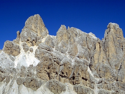
Via della Pace - Furcia Rossa

 1 / 3
1 / 3
Via della Pace
 Planetmountain
Beauty


By
Planetmountain.com
Orientation
Southwest
Ascent height difference
1000m
Ferrata height difference
300m
Height
2781m
Difficulty
Medium
Time
6 hours
Period
From the end of June until September, depending on snow conditions.
Popularity
low
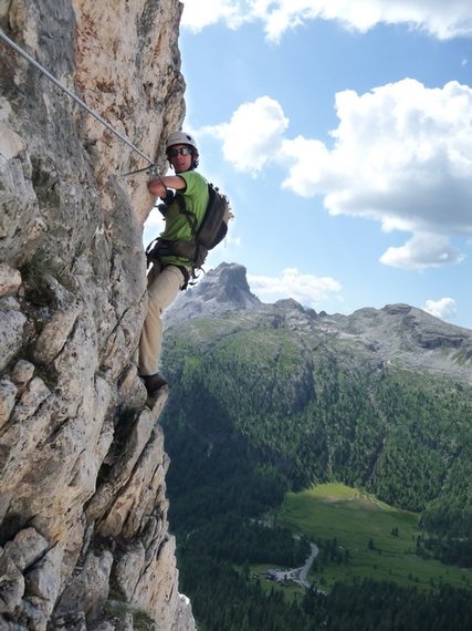
The “Via della Pace”, or Peace Way, is a long excursion that crosses the southwest face of the Furci Rossa. The fascinating alpine route in wild surroundings follows the front held by the Austrian troops in the First World War. A short ferrata with ladders and cables leads up to Furcia Rossa III, one of the peaks in the Furcia Rossa chain which, separated by the deep Valle Travenanzes, “looks out” onto Tofane, defended by the Italians.
Getting there
1) From Passo Falzarego or S. Cassiano take the Passo di Valparola road and turn off (north) at the Ru Sciare bridge to reach Capanna Alpina all’Armentarola (1726m).
2) From S. Vigilio di Marebbe drive to Rifugio Pederù. Access
1) From Capanna Alpina take path no. 11 and cross Plan de Furcia to climb swiftly up to Col de Lòcia (2069m). Continue past Passo Tadega (2157m) and descend slightly to Alpe Fanes Grande (2 hrs). Take the path marked VB17 rightwards to ascend to Vallon del Fosso and, at the fountain (2402m – 1 hr) follow the markers (FR). Keep left and descend slightly, following the wide ledge/ramp, to reach the start.
2) From Rif. Pederù walk to Rif Fanes (2060m) and proceed to Alpe di Fanes Grande (2 hrs). Continue from here as described above. Itinerary
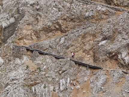
Begin by following the wide ledge which traverses rightwards beneath black overhanging rocks. The line leads towards the break in the crest between Furcia Rossa II and III but, instead of reaching this col, continues along the west face. The vertical and exposed sections are surmounted with the help of ladders and fixed cables, to then reach the scree slopes beneath the summit of Furcia Rossa III. A steep path leads quickly to the top, the Austrian outposts and a magnificent sweeping view onto even the farthest alpine peaks. Descent
Descend southwest and, after having passed the col that separates Furcia Rossia III from IV, reach the vertical yellow wall, about 100m high. Ladders and iron rungs lead down this to the Vallon Bianco scree slopes. Continue southwest to reach the Bivacco della Pace (2676m) bivouac, at the base of towering M.te Castello. Return from here along path no. 17 to Alpe Fanes Grande and then either to Rifugio Fanes or Capanna Alpina all’Armentarola. Gear
Normal via ferrata kit. Maps/Bibliography
Via Ferratas of the Italian Dolomites: Vol 1 by John Smith and Graham Fletcher . Cicerone Press 2002 Difficulty
A long itinerary in an isolated environment which requires experience and good mountaineering skills. Its length also makes it physically tough. Particular care is also required as in some parts the fixed cables are poorly maintained. There are some very exposed sections which are mostly climbed using ladders. Bear in mind that the Fanes refuge is closer than Armentarola.
 Comments
13/08/2005 marcello cominetti
Percorro sovente l' alta via della pace, ma la descrizione non include la parte più bella che è quella che arriva fino alla cima Vallon Bianco dove ci sono opere di guerra come da nessun' altra parte di questa zona dolomitica si incontrano. sarebbe un peccato rientrare dal vallon del fosso senza avere completato l' itinerario... comunque l' attrezzatura è stata ripristinata due anni fa dalle guide della val badia e di cortina ed è ottima! certo che così si aggiungono un buon paio d' ore di cammino, ma ne vale sicuramente la pena.
20/07/2003 fabio perbellini
la ferrata si prersenta in ottime condizioni, la fune d'acciaio e le scalette sono completamente nuove e ben salde,siamo partiti a piedi dall'entrata del parco poco dopo cortina, abbiamo dormito al biv. della pace, siamo scesi il gg dopo,veramente lunghissimo il primo giorno, fisicamente impegnativo.
30/03/2002 Ernesto Majoni
Il mio commento non è aggiornato, e ricordo che già allora non era in condizioni ottimali. Quest'anno le guide di Cortina la rimetteranno a posto. Il valore della ferrata è minimo rispetto a quello ambientale e storico della zona. Un'escursione assolutamente da fare, anche se, dal versante di Cortina, è veramente lunghissima.
Beauty


By
Planetmountain.com
Orientation
Southwest
Ascent height difference
1000m
Ferrata height difference
300m
Height
2781m
Difficulty
Medium
Time
6 hours
Period
From the end of June until September, depending on snow conditions.
Popularity
low
Routes in the same mountain group


 Copia link
 Planetmountain.com


