Roter Kogel

 1 / 4
1 / 4
Roter Kogel
 Planetmountain
Beauty


By
Roberto Iacopelli, Mountain Guide. Taken from the book 'Scialpinismo in Tirolo' Ed. Versante Sud
Ascent height difference
1740m
Descent height difference
1740m
Height
2832m
Difficulty
Easy
Time
5 - 6 hours
Ascent exposition
N/E N
Descent exposition
N/E N
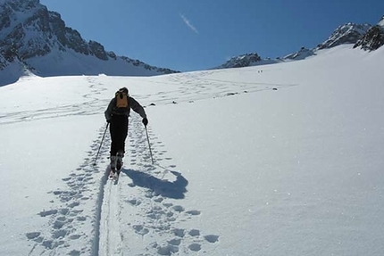
With Roter Kogel we are dealing with the longest winter ascent of the area and not only in terms of vertical height gain, but also in terms of length. This is a safe trip which can be undertaken even after a snowfall as it never tackles critical slopes for this type of situation. You only need a minimum amount of care in tracking it and that way you will keep out of danger. Due to this characteristic it is very frequented and consequently is almost always tracked. In spite of the long boring forestry road section up to the Potsdamer, which is a sledge run, it really is a great trip. The main thing is to set off slowly, maybe even chatting to your friends and time will pass quickly till suddenly the hut’s enchanting site will appear before you. From this point onwards the itinerary on open terrain is wonderfully relaxing with a subsequent beautiful descent in powder snow. You may stay overnight if you wish at the hut which is usually open from 30/12 to 08/01 and 28/01 till Easter. www.potsdamer.at tel. 0043/5238/52060.
Access
From Innsbruck reach Kematen (10km to the west of Innsbruck). Itinerary
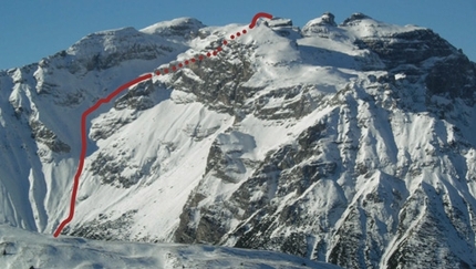
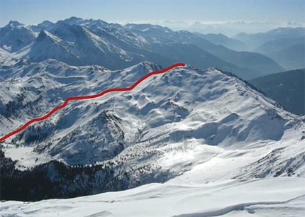
From Innsbruck reach Kematen and climb up to the valley of Sellrain to the town of Sellrain. From here a road branches off to the left with indications for Axams and surrounding areas including signs for the Potsdammer Hut. Go up the steep road till you reach the bend which turns under Fotschertal (see map). Park after the bridge, and turning back, take the valley road which during winter is a sledge run which is very popular with families. If you go up towards the hut during the afternoon watch out for racing kids! Ascend the long road up to Bergheim Fotsch and after this continue along the left branch of the valley along a pisted road which brings you to Potsdamer Hütte. From the hut go up to the right and climb the slopes which progressively take you to a buttress where, up and down, beyond its base you will Kastengrat till you go into the Widdersberg–Schafalm valley. Follow its length to right under the Roter Kogel to gain its eastern ridge, with a diagonal ascent to the left. Along this you will shortly reach the summit keeping your skis on till the very last few metres. Descent
Along the ascent route right under the base of Kastengrat (see map: Mötterl - 2195 m.) then, before again going up the tracks you made going to the refuge on your way to the summit, descend the valley to reach Bergheim Fotsch directly. From here go back along the road/sledge run, without picking up too much speed, as far as the car park at the Fotschertal bend. Gear
Normal ski mountaineering equipment Maps/Bibliography
Scialpinismo in Tirolo. Le più belle gite tra Innsbruck e il Brennero by Roberto Iacopelli, Versante Sud. In Italian, German and English
 Comments
No comments yet...
Beauty


By
Roberto Iacopelli, Mountain Guide. Taken from the book 'Scialpinismo in Tirolo' Ed. Versante Sud
Ascent height difference
1740m
Descent height difference
1740m
Height
2832m
Difficulty
Easy
Time
5 - 6 hours
Ascent exposition
N/E N
Descent exposition
N/E N
Routes in the same mountain group


 Copia link
 Roberto Iacopelli, Mountain Guide. Taken from the book 'Scialpinismo in Tirolo' Ed. Versante Sud


