Monte Cogliàns

 1 / 2
1 / 2 Planetmountain


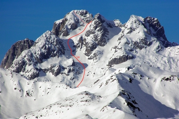
Classic and popular ski mountaineering itinerary to the summit of the highest peak in the Carnia Alps. This route is highly representative of what this mountain range has to offer, with a long and regular sunny descent. The final climb to the summit proper is very steep and can only be ascended and skied down in ideal snow conditions.
From Forni Avoltri follow the access road up to Collina, then continue to the car park near Rifugio Tolazzi. Sometimes this part of the road is badly trodden and there is no other choice than leaving the car after Collina and reaching the hut on foot (10-15 min).
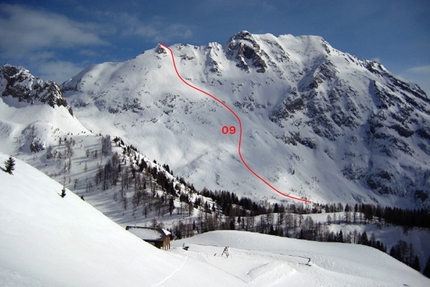
ItineraryFrom Rifugio Tolazzi follow the forest trail leading to Casera Morarêt. When the trail comes out into the open at 1585 m, leave it and go straight up through the woods along the right flank of the mountain. After emerging from the woods at approx 1800 m, follow the shallow gully on the right, which takes you to the basin at the base of the beautiful Torre del Coston Stella. Go through the wide Vallone del Ploto along the left branch to reach a plateau with boulders at approx 2570 m, then a small saddle to the right of the summit of Mount Cogliàns, where you can leave your skis. The last hundred metres are very steep (ice axe and crampons essential), and are to be covered obliquely towards the left (exposed and rocky) to reach the cross on the peak.
DescentDescend along the line of ascent.The descent right from the summit can only be carried out in perfect snow conditions.
NotesBS, OSA 40°-45°, the first 100 m from the summit, ice axe and crampons
Maps/BibliographyTabacco map 01.
Scialpinismo in Carnia. Itinerari scelti nelle Alpi Carniche di Scuola Carnica di Alpinismo e Scialpinismo "Cirillo Floreanini" - Tolmezzo
 Comments


Show more in Alpi Carniche


 Copia link
 Massimo Candolini, UIAGM Mountain Guide

